

🏔️ La RumorosaThe pass, El Vallecito and the overlooks of the sierra
Where the wind "murmurs" among the rocks, the road winds down toward the Mexicali valley. Ancient rock paintings, dizzying overlooks, a wind farm and a mountain village: the most spectacular day trip near the city.
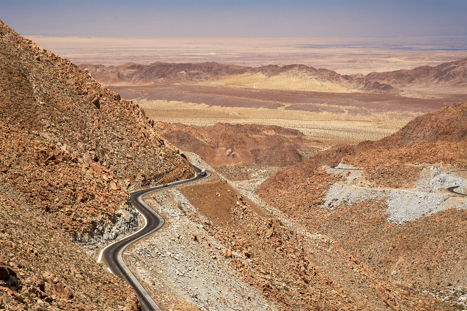
"Few views sum up northern Baja California as well as the descent of La Rumorosa into the desert"
What is La Rumorosa?
La Rumorosa is, all at once, a town, a road and an entire region of the Sierra de Juárez, in the municipality of Tecate. For anyone leaving Mexicali, it is the first big climb into the mountains: barely an hour from the city, the desert turns into granite canyons and cool air.
Its name is born of the wind: it blows tirelessly among the rocks and gorges of the sierra, producing a constant murmur—a "rumor"—that gives the whole place its name. That same wind is now the raw material for the wind farm that crowns the range.
The La Rumorosa pass—the stretch of Federal Highway 2D between Tecate and Mexicali—is famous across Mexico for its curves, grades and views: from the top you can see the sierra plunge toward the plain of the Mexicali valley. But the area is much more than the road: this is where the El Vallecito rock paintings, around 3,000 years old, and the famous Diablito that lights up at the winter solstice are found.
🏔️ La Rumorosa by the numbers
How to Get There from Mexicali
🚗 By car (the easiest way)
- 1From Mexicali take Federal Highway 2 / 2D toward Tecate
- 2Cross the valley and the Laguna Salada to the foot of the sierra
- 3Climb the La Rumorosa pass slowly (curves and grade)
- 4At the top you reach the town of La Rumorosa (~1 hour total)
- 5For El Vallecito, follow signs toward Ejido Jacumé (short dirt stretch)
⏱️ Approx. travel times
- • From Mexicali: ~1 hour (73 km)
- • From Tecate: ~30 minutes
- • From Tijuana: ~1.5 hours
⛽ Before you go
Leave Mexicali with a full tank and the car checked. In the sierra cell signal is intermittent and services are limited.
Bring cash: both El Vallecito and the food stands in town usually only take cash.
🗺️ Open in maps
Navigate straight to the town or the archaeological zone.