

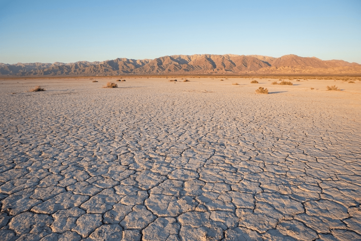
Laguna Salada
Mexicali’s dry lake: 60 km of flat bed below sea level, between the Sierra Cucapá and the Sierra de Juárez
Laguna Salada: how to get there, what to drive and when to go
- Distance
- ~30 km from Mexicali on Highway 2 (30–45 min)
- Cost
- No toll booth or fee recorded (no official confirmation)
- Vehicle
- Regular car to the edge; 4x4 to cross it
- When to go
- October to April; never after recent rain
- Elevation
- About 10 m below sea level
- Services
- None: no water, shade or reliable signal
Information verified on October 22, 2026 against the Google listing, published studies and local press. This is open desert: safety is on you.
About Laguna Salada
Laguna Salada is a huge closed basin southwest of Mexicali: a clay-and-salt bed about 60 kilometers long and 17 wide, stretched between the Sierra Cucapá to the east and the Sierra de Juárez to the west, with Cerro El Centinela closing off the northern tip. Its floor lies about 10 meters below sea level, making it one of the lowest places in Mexico. It is a tectonic trough tied to the San Andreas fault system, the same one that continues north to the Salton Sea.
A lake that comes and goes
For centuries the lake filled with Colorado River floods that entered through the delta and the Hardy River, and in exceptional tides even with water from the Gulf of California. Records document a "large lake with abundant fish" in 1884, and fillings in 1890, 1893 and 1905–1907, the same floods that created the Salton Sea. The Cucapá crossed it every year on their way to the Sierra de Juárez and planted along its shores when fresh water came in. Today the Colorado is almost entirely diverted, so the lake lives dry: its last long wet period ran from 1978 to the late 1980s, with fishing and tourism, plus a brief return in 1997–1999 and a shallow sheet of water after Tropical Storm Kay in September 2022.
Pavarotti, a Boeing and the races
The vast, empty flat has hosted some unusual events. On October 18, 2003, for Mexicali’s centennial, Luciano Pavarotti sang here to some 40,000 people in nearly 48 °C heat at one in the afternoon. On April 27, 2012, Discovery Channel deliberately crashed an unmanned Boeing 727 here for the documentary "Plane Crash", and that same year UABC students launched the Cimarrón I rocket, the first in Baja California. Scenes from "Resident Evil: Extinction" were filmed here, and in 2013 a Trophy Truck hit 219 km/h on the bed. Motorcycle, quad and buggy series race here every year: in 2026 the ZR Promotions Triple Corona, Racing For Boobs in March and the Mex Log 300 in October, with over 90 teams and grandstands at kilometer 28.
Getting there and what to expect
Leave Mexicali on the free Federal Highway 2 toward Tecate; the highway crosses the lake bed and, if you keep climbing the La Rumorosa grade, the lookouts show the whole basin. The north entrance is marked by large red pillars: pavement at first, then dirt. A regular car reaches the edge and the first few kilometers along the compacted tracks; to cross it or continue to Guadalupe Canyon you need a high-clearance truck or 4x4. There are no services, water, shade or reliable signal: only a few red masts with a map, an emergency button and a water reserve.
Safety: the desert is unforgiving
Mexicali Civil Protection asks people to stay out of the desert between May and October, when wild areas exceed 52 °C and "there is no safe time of day". After rain the bed turns into deep mud that traps even trucks: in July 2019 a family of ten spent the night stuck on the way to Guadalupe Canyon until a Navy helicopter found them, and there were two more rescues in 2022. In October 2026 the state government denied permits for a sky-lantern festival in the area over environmental risk: local biologists point out that the lake bed holds ecosystems worth conserving, so leave no trash and stay on the tracks.
Photography
Sunsets over the cracked bed with the Sierra Cucapá behind; the classic shot of the lake.
Off-road
Motorcycle, quad and buggy series from March to October; grandstands at km 28 on Highway 2.
Road to the canyon
Along the west edge of the lake you continue to Guadalupe Canyon and its hot springs (4x4, reservation).
Before you go
Good to know
Extra water and a heads-up
Carry more water than you think you need, a full tank, and tell someone your route and return time: signal drops out there.
Stay on the tracks
The crust looks solid but breaks; follow the compacted tracks and do not go more than a few kilometers in with a regular car.
Not after rain
For days after rain the bed is deep mud: it has trapped trucks and prompted helicopter rescues.
Wind and sun
It is almost always windy and there is no shade: hat, sunglasses, sunscreen and something to cover up from the dust.
⭐ What people say
“A highway with unique views of the Mexicali desert. La Salada always delivers stunning scenery, though you have to drive very carefully because of the weather and wind.”
— Marlet · Google · May 2026
“A very nice place if you like wide-open spaces. Very windy. You can drive in with any vehicle but I would not go more than 10 km in. Luciano Pavarotti sang here, too.”
— Reed Murray · Google · May 2026
“You can drive in with any car: there is pavement at first, then it ends and the dirt road starts, but it is not bad. It is very hot, and if you catch the sunset you will love it.”
— Dina Nahily Valenzuela Roque · Google · September 2022
“After more than 30 years it had water, and it is a beautiful sight.”
— Miguel Lucatero · Google · September 2022
Real Google reviews with author and date (translated from Spanish). The rating may change.
Frequently asked questions
Does Laguna Salada have water?
Why is it dry?
How far is it from Mexicali and how do I get there?
Can I drive in with a regular car?
How much does it cost?
When is the best time to go?
Can I camp there?
Is there cell service?
What makes it special?
Sources
- Laylander et al., "Laguna Salada", PCAS Quarterly 52(1), 2016 (geography, flood history, Cucapá)
- Mex Log 300 brings 90+ teams to Laguna Salada (El Imparcial, October 10, 2026, in Spanish)
- Triple Corona 2026 at Laguna Salada (El Imparcial, July 8, 2026, in Spanish)
- Civil Protection warns of extreme-heat risks (El Imparcial, July 10, 2026, in Spanish)
- 10 people rescued from Laguna Salada (Zeta, July 16, 2019, in Spanish)
- 2012 Boeing 727 crash experiment (Wikipedia)
- Sky-lantern festival denied permits over environmental impact (Zeta, October 12, 2026, in Spanish)
Basin facts
- Lake bed
- ~60 × 17 km
- Whole basin
- 82 × 29 km · 820 km²
- Floor
- ~10 m below sea level
- Rainfall
- 67.6 mm a year (SMN 1974–90)
- Extremes
- 50 °C in July · −8 °C in January
- Last time with water
- 1978–1989 · 1997–99 · Sep 2022 (brief)
Location
Federal Highway 2 (Mexicali–Tecate)
Between the Sierra Cucapá and the Sierra de Juárez
Mexicali municipality, B.C.